 Ete N
Ete N
Current Status
Where is the vessel?
Ete N is currently in Near Port Said East, based on AIS data received about 15h ago.
Latest AIS update:
Current position: 31.20009° N, 32.35239° E (Near Port Said East)
Average speed (last 7 days): Loading…
Average speed (last 30 days): Loading…
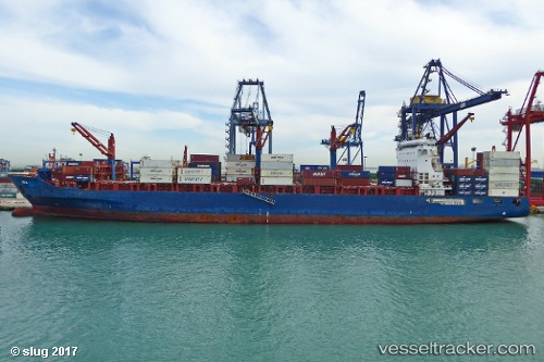
Vessel profile: Ete N is a Container Ship with dimensions 212m x 33m.
This page combines live AIS, route history, probable destination signals, nearby traffic, and port activity for practical vessel monitoring.
The current position of vessel Ete N is 31.20009 lat / 32.35239 lng. Updated: 2026-05-24 07:59:02 UTCNearest reference points:
- Near Port Said East
- Near Port Said
- 14 nm N of Port Said
Currently sailing under the flag of Liberia ![]()
Ete N built in 2012 year
Deadweight:
41139 tDetails:
Live Vessel Ete N Analytics (details, animations, etc.)
Recent AIS points (UTC):
2026-05-24 04:31:05 UTC · 31.43092, 32.42377 · SOG 10.9 kn · COG 207°2026-05-24 05:55:03 UTC · 31.20828, 32.35227 · SOG 3.3 kn · COG 192°
2026-05-24 07:23:03 UTC · 31.20009, 32.35242 · SOG 0 kn · COG 193°
2026-05-24 07:59:02 UTC · 31.20009, 32.35239 · SOG 0 kn · COG 193°