.

LB flag XH NAVIGATOR

Vessel type: Bulk Carrier | IMO: 9330824 | MMSI: MMSI: 636020688
Call sign: 5LAF7 | Dimensions: 45 m x 289 m
Current Status

Where is the vessel?

XH NAVIGATOR is currently in 13 nm S of Maji Shan, based on AIS data received about 15h ago.

Latest AIS update:

Current position: 30.45892° N, 122.46973° E (13 nm S of Maji Shan)

Average speed (last 7 days): Loading…

Average speed (last 30 days): Loading…

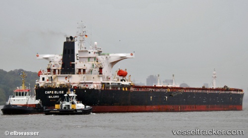
Vessel profile: XH NAVIGATOR is a Bulk Carrier with dimensions 45m x 289m.

This page combines live AIS, route history, probable destination signals, nearby traffic, and port activity for practical vessel monitoring.

The current position of vessel XH NAVIGATOR is 30.45892 lat / 122.46973 lng. Updated: 2026-05-24 01:45:42 UTC
More recent position available: 1 h 0 min ago
Free positions are delayed by 14 hours.

We recommend registering. If you register, paid vessel access will be saved in your profile. Guest access works only through a personal link.

Nearest reference points:
  • 14 nm NE of JINHAI HEAVY INDUSTR
  • 10 nm NE of JINHAI HEAVY INDUSTR
  • 11 nm N of JINHAI HEAVY INDUSTR

Currently sailing under the flag of Liberia LB flag

XH NAVIGATOR built in 2005 year

Deadweight:
174124 t

Details:

Live Vessel XH NAVIGATOR Analytics (details, animations, etc.)


Recent AIS points (UTC):
2026-05-23 23:00:38 UTC · 30.46067, 122.47075 · SOG 0.1 kn · COG 263°
2026-05-23 23:58:08 UTC · 30.45903, 122.47038 · SOG 0.1 kn · COG 305°
2026-05-24 01:13:17 UTC · 30.45897, 122.47007 · SOG 0 kn · COG -1°
2026-05-24 01:45:42 UTC · 30.45892, 122.46973 · SOG 0.1 kn · COG 328°

UTC: --
Start: -- Track timeline (UTC) End: --
Encountered: --


Link to the map:


Find another ship

XH_NAVIGATOR (636020688) last ports (portcalls and passsages)

Sebang | 2025-08-17 19:04:18
PULAU SAMBU | 2025-08-15 06:35:00
TEKONG ISLAND | 2025-08-14 11:00:06
TANAH MERAH | 2025-08-14 09:17:44
PENGERANG | 2025-08-14 07:30:32
Fangcheng | 2025-08-03 07:17:49
TANAH MERAH | 2025-07-23 23:46:21
PULAU SAMBU | 2025-07-23 21:36:28
Port Louis | 2025-07-02 11:06:04
Sebang | 2025-02-03 10:12:53
PULAU SAMBU | 2025-01-31 16:53:35
TANAH MERAH | 2025-01-30 21:12:44
PENGERANG | 2025-01-30 19:26:12
Wusong | 2025-01-20 21:08:13
Taicang | 2025-01-20 19:23:15
Zhangjiagang | 2025-01-20 08:55:25
GAOGANG | 2025-01-17 00:32:19
Taixing | 2025-01-16 15:47:40
Nantong | 2025-01-16 10:13:22
Taicang | 2025-01-16 07:17:06
Wusong | 2025-01-16 05:02:23
LANSHAN | 2025-01-11 07:30:38
PENGERANG | 2024-12-24 07:53:52
TANAH MERAH | 2024-12-24 06:27:33
BATU AMPAR | 2024-12-24 05:43:01
Port Elizabeth | 2024-10-13 02:28:41
Port Elizabeth | 2024-10-09 02:24:29
Port Elizabeth | 2024-10-05 01:46:36
Durban | 2024-10-03 10:25:10
Sebang | 2024-09-14 05:51:01
Sambu | 2024-09-12 03:25:35
Sambu | 2024-08-26 04:36:03
Singapore | 2024-08-20 18:36:41
Jingjiang | 2024-08-10 18:39:16
Wusong | 2024-08-10 12:45:27
Taicang | 2024-08-10 10:46:25
Taixing | 2024-08-06 15:03:10
Zhangjiagang | 2024-08-06 11:24:48
Taicang | 2024-08-06 06:43:51
Wusong | 2024-08-06 05:12:03
Pei-Hai | 2024-07-31 12:32:57
Fangcheng | 2024-07-27 16:50:22
Sebang | 2024-04-13 13:30:12
Gladstone Harbor | 2024-03-11 08:10:02
Jingjiang | 2024-02-20 20:24:11
Wusong | 2024-02-20 15:12:50
Taixing | 2024-02-17 03:22:34
Zhangjiagang | 2024-02-17 00:55:32
Nantong | 2024-02-16 22:52:47
Taicang | 2024-02-16 09:51:47
Wusong | 2024-02-16 08:13:15
Selat Lombok | 2024-01-16 00:19:25
Nantong | 2023-11-25 00:03:08
Taicang | 2023-11-24 17:16:49
Wusong | 2023-11-24 14:02:12
Jingjiang | 2023-11-24 08:19:20
Newcastle | 2023-10-28 17:26:47
Zhangjiagang | 2023-09-05 07:13:05
Nantong | 2023-09-05 04:53:45
Taicang | 2023-09-05 00:56:07
Wusong | 2023-09-04 07:21:55
Jingjiang | 2023-09-04 01:26:43
Samson Point | 2023-08-15 05:30:43
Dampier | 2023-07-03 03:19:55
Sambu | 2023-06-04 17:53:26
Port Elizabeth | 2023-03-23 02:48:43