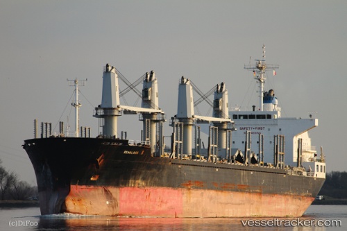
 SEAGLASS II
Current Status
Where is the vessel?
SEAGLASS II is currently in Near BENGHAZI, based on AIS data received about 16h ago.
Latest AIS update:
Current position: 32.14802° N, 19.98504° E (Near BENGHAZI)
Average speed (last 7 days): Loading…
Average speed (last 30 days): Loading…
Vessel profile: SEAGLASS II is a Bulk Carrier with dimensions m x m.
This page combines live AIS, route history, probable destination signals, nearby traffic, and port activity for practical vessel monitoring.
The current position of vessel SEAGLASS II is 32.14802 lat / 19.98504 lng. Updated: 2026-05-23 07:56:21 UTCNearest reference points:
- Near BENGHAZI
- Near Banghazi
- 61 nm N of Al Marj
Currently sailing under the flag of Liberia ![]()
Details:
Live Vessel SEAGLASS II Analytics (details, animations, etc.)
Recent AIS points (UTC):
2026-05-23 04:20:23 UTC · 32.14745, 19.98370 · SOG 0 kn · COG 352°2026-05-23 05:21:13 UTC · 32.14667, 19.98333 · SOG 0 kn · COG -1°
2026-05-23 07:33:45 UTC · 32.14813, 19.98509 · SOG 0 kn · COG -1°
2026-05-23 07:56:21 UTC · 32.14802, 19.98504 · SOG 0 kn · COG 309°