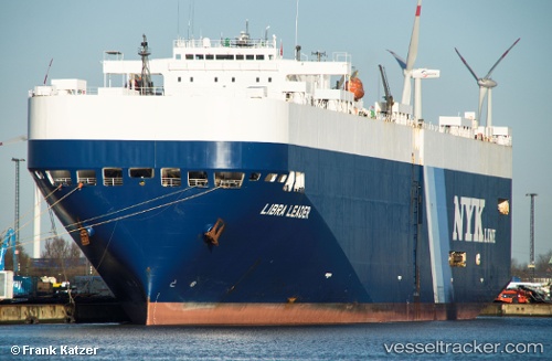
 LIBRA LEADER
Current Status
Where is the vessel?
LIBRA LEADER is currently in Open sea (no nearby ports in database), based on AIS data received about 14h ago.
Latest AIS update:
Current position: 30.66558° N, 168.87601° E (Open sea (no nearby ports in database))
Average speed (last 7 days): Loading…
Average speed (last 30 days): Loading…
Vessel profile: LIBRA LEADER is a Vehicles Carrier with dimensions m x m.
This page combines live AIS, route history, probable destination signals, nearby traffic, and port activity for practical vessel monitoring.
The current position of vessel LIBRA LEADER is 30.66558 lat / 168.87601 lng. Updated: 2026-05-23 17:34:34 UTCNearest reference points:
- Open sea (no nearby ports in database)
Currently sailing under the flag of Liberia ![]()
Details:
Live Vessel LIBRA LEADER Analytics (details, animations, etc.)
Recent AIS points (UTC):
2026-05-23 13:32:03 UTC · 30.77324, 169.70691 · SOG 11 kn · COG 257°2026-05-23 15:36:54 UTC · 30.71578, 169.27371 · SOG 10.7 kn · COG 257°
2026-05-23 16:21:21 UTC · 30.69547, 169.12175 · SOG 10.8 kn · COG 261°
2026-05-23 17:34:34 UTC · 30.66558, 168.87601 · SOG 9.9 kn · COG 257°