 SEA GULL
Current Status
Where is the vessel?
SEA GULL is currently in Near ROBBEN ISLAND, based on AIS data received about 15h ago.
Latest AIS update:
Current position: 33.84970° S, 18.25025° E (Near ROBBEN ISLAND)
Average speed (last 7 days): Loading…
Average speed (last 30 days): Loading…
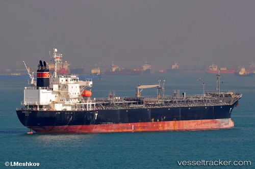
Vessel profile: SEA GULL is a Oil/Chemical Tanker with dimensions m x m.
This page combines live AIS, route history, probable destination signals, nearby traffic, and port activity for practical vessel monitoring.
The current position of vessel SEA GULL is -33.84970 lat / 18.25025 lng. Updated: 2026-05-23 10:22:27 UTCNearest reference points:
- 12 nm W of ROBBEN ISLAND
- Near Cape Town
- Near Ben Schoeman Dock
Currently sailing under the flag of Liberia ![]()
Details:
Live Vessel SEA GULL Analytics (details, animations, etc.)
Recent AIS points (UTC):
2026-05-23 07:41:16 UTC · -33.85887, 18.21654 · SOG 0.7 kn · COG 138°2026-05-23 08:00:28 UTC · -33.85848, 18.22021 · SOG 1 kn · COG 140°
2026-05-23 10:18:58 UTC · -33.85005, 18.24946 · SOG 1 kn · COG 142°
2026-05-23 10:22:27 UTC · -33.84970, 18.25025 · SOG 0.6 kn · COG 142°