 SAVITRI
Current Status
Where is the vessel?
SAVITRI is currently in 55 nm NW of Ponta do Pargo, based on AIS data received about 14h ago.
Latest AIS update:
Current position: 33.44212° N, 18.01766° W (55 nm NW of Ponta do Pargo)
Average speed (last 7 days): Loading…
Average speed (last 30 days): Loading…
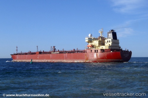
Vessel profile: SAVITRI is a Oil Products Tanker with dimensions m x m.
This page combines live AIS, route history, probable destination signals, nearby traffic, and port activity for practical vessel monitoring.
The current position of vessel SAVITRI is 33.44212 lat / -18.01766 lng. Updated: 2026-05-24 07:43:50 UTCNearest reference points:
- 150 nm NW of Ponta do Pargo
- 124 nm SW of Ponta do Pargo
- 78 nm W of Nedroma
Currently sailing under the flag of Sierra Leone ![]()
Details:
Live Vessel SAVITRI Analytics (details, animations, etc.)
Recent AIS points (UTC):
2026-05-24 05:12:00 UTC · 33.51579, -18.01112 · SOG 1.7 kn · COG 123°2026-05-24 05:37:30 UTC · 33.50362, -18.01112 · SOG 1.6 kn · COG 126°
2026-05-24 07:35:38 UTC · 33.44602, -18.01757 · SOG 1.6 kn · COG 114°
2026-05-24 07:43:50 UTC · 33.44212, -18.01766 · SOG 1.7 kn · COG 114°