 ANNA 1
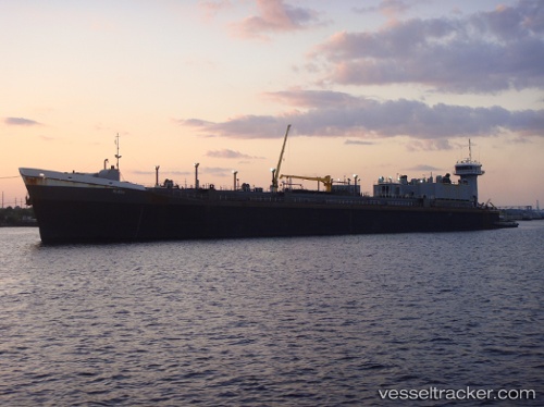
Current Status
Where is the vessel?
ANNA 1 is currently in Near El Chaure, based on AIS data received about 14h ago.
Latest AIS update:
Current position: 10.25155° N, 64.66815° W (Near El Chaure)
Average speed (last 7 days): Loading…
Average speed (last 30 days): Loading…
Vessel profile: ANNA 1 is a Articulated Pusher Tug with dimensions m x m.
This page combines live AIS, route history, probable destination signals, nearby traffic, and port activity for practical vessel monitoring.
The current position of vessel ANNA 1 is 10.25155 lat / -64.66815 lng. Updated: 2026-05-23 23:30:14 UTCNearest reference points:
- Near Puerto Sucre
- 15 nm SW of Punta de Piedras
Currently sailing under the flag of Tanzania ![]()
Details:
Live Vessel ANNA 1 Analytics (details, animations, etc.)
Recent AIS points (UTC):
2026-05-23 20:06:13 UTC · 10.25155, -64.66808 · SOG 0.1 kn · COG 42°2026-05-23 21:33:14 UTC · 10.25158, -64.66813 · SOG 0 kn · COG 43°
2026-05-23 22:18:12 UTC · 10.25167, -64.66821 · SOG 0.1 kn · COG 46°
2026-05-23 23:30:14 UTC · 10.25155, -64.66815 · SOG 0 kn · COG 43°