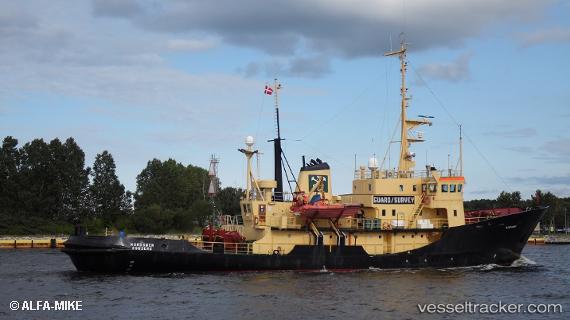
 MV NANOOK
Current Status
Where is the vessel?
MV NANOOK is currently in 119 nm N of Ny-Ålesund, based on AIS data received about 14h ago.
Latest AIS update:
Current position: 80.86849° N, 14.23315° E (119 nm N of Ny-Ålesund)
Average speed (last 7 days): Loading…
Average speed (last 30 days): Loading…
Vessel profile: MV NANOOK is a Salvage/Rescue Vessel with dimensions m x m.
This page combines live AIS, route history, probable destination signals, nearby traffic, and port activity for practical vessel monitoring.
The current position of vessel MV NANOOK is 80.86849 lat / 14.23315 lng. Updated: 2026-05-23 10:21:48 UTCCurrently sailing under the flag of Dominica ![]()
Details:
Live Vessel MV NANOOK Analytics (details, animations, etc.)
Recent AIS points (UTC):
2026-05-23 07:37:17 UTC · 80.90196, 14.20277 · SOG 0.3 kn · COG 51°2026-05-23 07:58:33 UTC · 80.90037, 14.21370 · SOG 0.3 kn · COG 54°
2026-05-23 10:09:07 UTC · 80.87333, 14.27833 · SOG 3 kn · COG -1°
2026-05-23 10:21:48 UTC · 80.86849, 14.23315 · SOG 4.2 kn · COG 306°