 GREENLAND
Current Status
Where is the vessel?
GREENLAND is currently in 50 nm SW of AMERI, based on AIS data received about 14h ago.
Latest AIS update:
Current position: 27.91269° N, 50.44300° E (50 nm SW of AMERI)
Average speed (last 7 days): Loading…
Average speed (last 30 days): Loading…
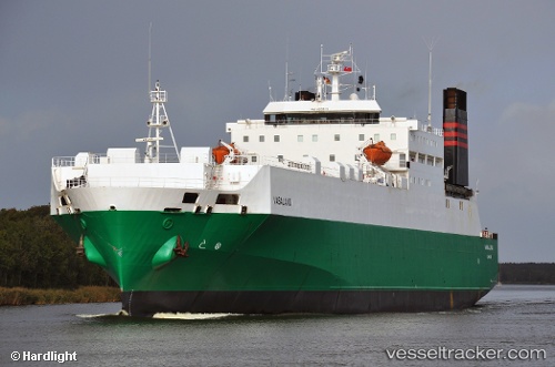
Vessel profile: GREENLAND is a Ro-Ro Cargo Ship with dimensions 155m x 25m.
This page combines live AIS, route history, probable destination signals, nearby traffic, and port activity for practical vessel monitoring.
The current position of vessel GREENLAND is 27.91269 lat / 50.44300 lng. Updated: 2026-05-24 07:27:06 UTCNearest reference points:
- 44 nm NE of Ras Al Khair
- 13 nm NE of AL JUBAIL
- 41 nm NE of Ras Al Khair
Currently sailing under the flag of St.Kitts and Nevis ![]()
GREENLAND built in 1984 year
Deadweight:
12870 tDetails:
Live Vessel GREENLAND Analytics (details, animations, etc.)
Recent AIS points (UTC):
2026-05-24 05:05:56 UTC · 27.64715, 50.67379 · SOG 8.9 kn · COG 323°2026-05-24 06:09:05 UTC · 27.76891, 50.56898 · SOG 8.4 kn · COG 318°
2026-05-24 07:24:06 UTC · 27.90733, 50.44799 · SOG 8.3 kn · COG 316°
2026-05-24 07:27:06 UTC · 27.91269, 50.44300 · SOG 8 kn · COG 322°