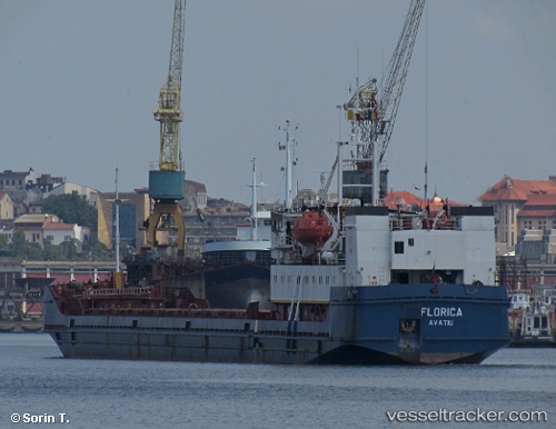
 FLORICA
Current Status
Where is the vessel?
FLORICA is currently in 10 nm S of Karatas, based on AIS data received about 15h ago.
Latest AIS update:
Current position: 36.38645° N, 35.43424° E (10 nm S of Karatas)
Average speed (last 7 days): Loading…
Average speed (last 30 days): Loading…
Vessel profile: FLORICA is a General Cargo with dimensions m x m.
This page combines live AIS, route history, probable destination signals, nearby traffic, and port activity for practical vessel monitoring.
The current position of vessel FLORICA is 36.38645 lat / 35.43424 lng. Updated: 2026-05-23 23:34:32 UTCNearest reference points:
- 13 nm W of Iskenderun
- Near YUMURTALIC
- Near CEYHAN
Currently sailing under the flag of Nauru ![]()
Details:
Live Vessel FLORICA Analytics (details, animations, etc.)
Recent AIS points (UTC):
2026-05-23 19:51:36 UTC · 36.53265, 35.81234 · SOG 5.1 kn · COG 233°2026-05-23 21:56:52 UTC · 36.42798, 35.62827 · SOG 5.5 kn · COG 240°
2026-05-23 22:25:31 UTC · 36.41690, 35.57398 · SOG 5.4 kn · COG 255°
2026-05-23 23:34:32 UTC · 36.38645, 35.43424 · SOG 6.1 kn · COG 256°