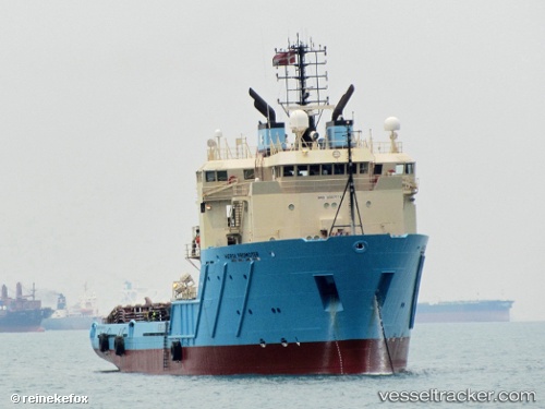
 AMAZON CHIEFTAIN
Current Status
Where is the vessel?
AMAZON CHIEFTAIN is currently in Near CARENAGE, based on AIS data received about 14h ago.
Latest AIS update:
Current position: 10.65893° N, 61.61767° W (Near CARENAGE)
Average speed (last 7 days): Loading…
Average speed (last 30 days): Loading…
Vessel profile: AMAZON CHIEFTAIN is a Anchor Handling Vessel with dimensions m x m.
This page combines live AIS, route history, probable destination signals, nearby traffic, and port activity for practical vessel monitoring.
The current position of vessel AMAZON CHIEFTAIN is 10.65893 lat / -61.61767 lng. Updated: 2026-05-24 08:25:31 UTCNearest reference points:
- Near Carenage
- Near CARENAGE
- Near Caroni
Currently sailing under the flag of Antigua and Barbuda ![]()
Details:
Live Vessel AMAZON CHIEFTAIN Analytics (details, animations, etc.)
Recent AIS points (UTC):
2026-05-24 05:01:31 UTC · 10.65927, -61.61791 · SOG 0 kn · COG 95°2026-05-24 05:31:31 UTC · 10.65920, -61.61787 · SOG 0 kn · COG 88°
2026-05-24 07:31:33 UTC · 10.65896, -61.61778 · SOG 0 kn · COG 35°
2026-05-24 08:25:31 UTC · 10.65893, -61.61767 · SOG 0 kn · COG 355°