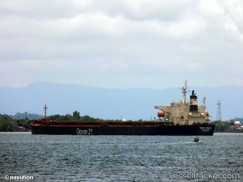
 RUBY INDAH
Current Status
Where is the vessel?
RUBY INDAH is currently in 70 nm N of KENDARI, based on AIS data received about 15h ago.
Latest AIS update:
Current position: 2.85486° S, 122.24290° E (70 nm N of KENDARI)
Average speed (last 7 days): Loading…
Average speed (last 30 days): Loading…
Vessel profile: RUBY INDAH is a Bulk Carrier with dimensions m x m.
This page combines live AIS, route history, probable destination signals, nearby traffic, and port activity for practical vessel monitoring.
The current position of vessel RUBY INDAH is -2.85486 lat / 122.24290 lng. Updated: 2026-05-23 23:59:52 UTCNearest reference points:
- 45 nm N of KENDARI
- 11 nm NW of KENDARI
- 22 nm S of Tangkiang
Currently sailing under the flag of Indonesia ![]()
Details:
Live Vessel RUBY INDAH Analytics (details, animations, etc.)
Recent AIS points (UTC):
2026-05-23 19:47:52 UTC · -2.85394, 122.24034 · SOG 0 kn · COG 69°2026-05-23 21:38:52 UTC · -2.85430, 122.24076 · SOG 0.1 kn · COG 54°
2026-05-23 22:59:52 UTC · -2.85543, 122.24334 · SOG 0.2 kn · COG 340°
2026-05-23 23:59:52 UTC · -2.85486, 122.24290 · SOG 0 kn · COG 325°