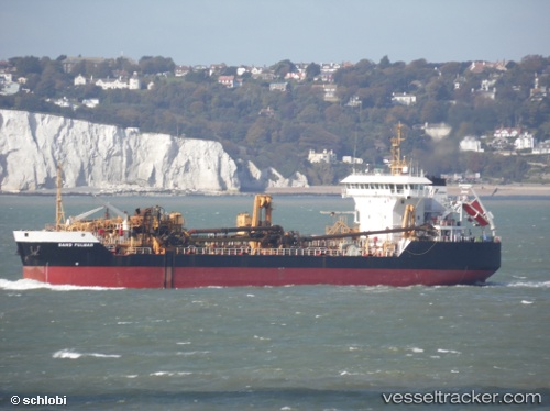
 SAND FULMAR
Current Status
Where is the vessel?
SAND FULMAR is currently in 10 nm E of Boxford, based on AIS data received about 15h ago.
Latest AIS update:
Current position: 51.95169° N, 1.69376° E (10 nm E of Boxford)
Average speed (last 7 days): Loading…
Average speed (last 30 days): Loading…
Vessel profile: SAND FULMAR is a Trailing Suction Hopper Dredger with dimensions m x m.
This page combines live AIS, route history, probable destination signals, nearby traffic, and port activity for practical vessel monitoring.
The current position of vessel SAND FULMAR is 51.95169 lat / 1.69376 lng. Updated: 2026-05-23 20:18:52 UTCNearest reference points:
- 11 nm NW of Krieschow
- Near Dovercourt
- Near Felixstowe
Currently sailing under the flag of Netherlands ![]()
Details:
Live Vessel SAND FULMAR Analytics (details, animations, etc.)
Recent AIS points (UTC):
2026-05-23 16:00:52 UTC · 51.94913, 1.69232 · SOG 0 kn · COG 36°2026-05-23 17:42:53 UTC · 51.94970, 1.69127 · SOG 0.1 kn · COG 76°
2026-05-23 20:00:52 UTC · 51.95126, 1.69435 · SOG 0 kn · COG 192°
2026-05-23 20:18:52 UTC · 51.95169, 1.69376 · SOG 1.3 kn · COG 250°