 YONG CHANG SHUN HANG
Current Status
Where is the vessel?
YONG CHANG SHUN HANG is currently in 105 nm E of Tan Cang Qui Nhon, based on AIS data received about 14h ago.
Latest AIS update:
Current position: 13.74264° N, 111.63554° E (105 nm E of Tan Cang Qui Nhon)
Average speed (last 7 days): Loading…
Average speed (last 30 days): Loading…
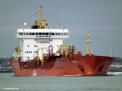
Vessel profile: YONG CHANG SHUN HANG is a Oil/Chemical Tanker with dimensions m x m.
This page combines live AIS, route history, probable destination signals, nearby traffic, and port activity for practical vessel monitoring.
The current position of vessel YONG CHANG SHUN HANG is 13.74264 lat / 111.63554 lng. Updated: 2026-05-23 21:58:17 UTCNearest reference points:
- 29 nm NE of Vung Ro
- 222 nm E of Tan Cang Qui Nhon
- 232 nm E of Tan Cang Qui Nhon
Currently sailing under the flag of San Marino ![]()
Details:
Live Vessel YONG CHANG SHUN HANG Analytics (details, animations, etc.)
Recent AIS points (UTC):
2026-05-23 18:37:12 UTC · 13.18730, 111.30271 · SOG 11.1 kn · COG 26°2026-05-23 20:08:00 UTC · 13.43984, 111.43541 · SOG 11.6 kn · COG -1°
2026-05-23 21:30:42 UTC · 13.66397, 111.58740 · SOG 11.6 kn · COG 33°
2026-05-23 21:58:17 UTC · 13.74264, 111.63554 · SOG 12 kn · COG -1°