 Malacca Highway
Current Status
Where is the vessel?
Malacca Highway is currently in 24 nm SE of Studsvik, based on AIS data received about 14h ago.
Latest AIS update:
Current position: 58.41218° N, 17.76835° E (24 nm SE of Studsvik)
Average speed (last 7 days): Loading…
Average speed (last 30 days): Loading…
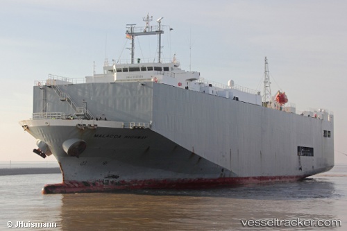
Vessel profile: Malacca Highway is a Vehicles Carrier with dimensions 139m x 23m.
This page combines live AIS, route history, probable destination signals, nearby traffic, and port activity for practical vessel monitoring.
The current position of vessel Malacca Highway is 58.41218 lat / 17.76835 lng. Updated: 2026-05-23 13:18:29 UTCNearest reference points:
- Near Stora Vika
- Near SODERTALJE
- Near Segeltorp
Currently sailing under the flag of Panama ![]()
Malacca Highway built in 2001 year
Deadweight:
6864 tDetails:
Live Vessel Malacca Highway Analytics (details, animations, etc.)
Recent AIS points (UTC):
2026-05-23 10:22:11 UTC · 57.66833, 17.45663 · SOG 15.4 kn · COG 13°2026-05-23 10:22:47 UTC · 57.67085, 17.45764 · SOG 15.4 kn · COG 13°
2026-05-23 12:22:53 UTC · 58.17928, 17.66895 · SOG 15.6 kn · COG 12°
2026-05-23 13:18:29 UTC · 58.41218, 17.76835 · SOG 15.4 kn · COG 13°