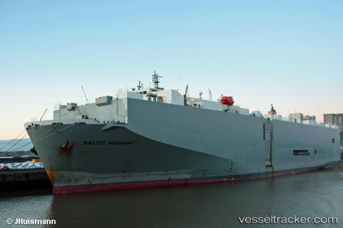
Baltic Highway
Current StatusWhere is the vessel?
Baltic Highway is currently in Near Ashdod Bonded, based on AIS data received about 15h ago.
Latest AIS update:
Current position: 31.81840° N, 34.60333° E (Near Ashdod Bonded)
Average speed (last 7 days): Loading…
Average speed (last 30 days): Loading…
Vessel profile: Baltic Highway is a Vehicles Carrier with dimensions 31m x 180m.
This page combines live AIS, route history, probable destination signals, nearby traffic, and port activity for practical vessel monitoring.
The current position of vessel Baltic Highway is 31.81840 lat / 34.60333 lng. Updated: 2026-05-23 10:13:19 UTCNearest reference points:
- Near AL ARISH
- 22 nm W of Haifa Granaries
- Near Haifa
Details:
Live Vessel Baltic Highway Analytics (details, animations, etc.)
Recent AIS points (UTC):
2026-05-23 07:31:18 UTC · 31.81917, 34.60310 · SOG 0 kn · COG 246°2026-05-23 07:43:18 UTC · 31.81915, 34.60310 · SOG 0.2 kn · COG 247°
2026-05-23 09:34:19 UTC · 31.81850, 34.60330 · SOG 0 kn · COG 277°
2026-05-23 10:13:19 UTC · 31.81840, 34.60333 · SOG 0 kn · COG 276°