.

HK flag ARINA

Vessel type: Crude Oil Tanker | IMO: 9248813 | MMSI: MMSI: 477957300
Call sign: VRWC6 | Dimensions: 274 m x 48 m
Current Status

Where is the vessel?

ARINA is currently in 40 nm W of Bentota River Apt, based on AIS data received about 14h ago.

Latest AIS update:

Current position: 6.19667° N, 79.34333° E (40 nm W of Bentota River Apt)

Average speed (last 7 days): Loading…

Average speed (last 30 days): Loading…

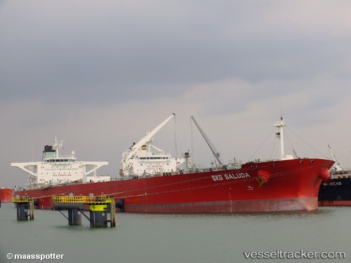
Vessel profile: ARINA is a Crude Oil Tanker with dimensions 274m x 48m.

This page combines live AIS, route history, probable destination signals, nearby traffic, and port activity for practical vessel monitoring.

The current position of vessel ARINA is 6.19667 lat / 79.34333 lng. Updated: 2026-05-23 11:45:39 UTC
More recent position available: 40 min ago
Free positions are delayed by 14 hours.

We recommend registering. If you register, paid vessel access will be saved in your profile. Guest access works only through a personal link.

Nearest reference points:
  • 67 nm SW of Moratuwa
  • 19 nm SW of Bataduwa
  • 38 nm SW of Galle

Currently sailing under the flag of Hong Kong HK flag

ARINA built in 2003 year

Deadweight:
159437 t

Details:

Live Vessel ARINA Analytics (details, animations, etc.)


Recent AIS points (UTC):
2026-05-23 07:39:05 UTC · 6.49568, 78.64340 · SOG 11.2 kn · COG 113°
2026-05-23 10:00:35 UTC · 6.31833, 79.04500 · SOG 11 kn · COG -1°
2026-05-23 10:04:47 UTC · 6.31506, 79.05728 · SOG 11 kn · COG 109°
2026-05-23 11:45:39 UTC · 6.19667, 79.34333 · SOG 11 kn · COG -1°

UTC: --
Start: -- Track timeline (UTC) End: --
Encountered: --


Link to the map:


Find another ship

ARINA (477957300) last ports (portcalls and passsages)

Covenas Offshore Terminal | 2025-09-15 12:46:31
POINT LISAS | 2025-08-03 13:04:48
Brighton | 2025-08-03 11:32:03
SUNGAI UDANG | 2025-06-22 14:11:18
MELAKA | 2025-06-21 23:18:46
SUNGAI UDANG | 2025-06-18 13:14:03
MELAKA | 2025-06-17 23:10:18
SUNGAI UDANG | 2025-06-14 11:59:47
MELAKA | 2025-06-13 22:24:24
SUNGAI UDANG | 2025-06-10 11:34:35
MELAKA | 2025-06-09 21:56:32
SUNGAI UDANG | 2025-06-06 09:52:36
MELAKA | 2025-06-05 19:46:47
PULAU SAMBU | 2025-06-01 14:14:16
Singapore | 2025-06-01 10:22:46
TANAH MERAH | 2025-06-01 08:18:55
PENGERANG | 2025-05-04 12:13:07
BATU AMPAR | 2025-05-04 10:13:08
MELAKA | 2025-05-01 00:07:24
Willemstad | 2025-03-08 23:18:41
Galeota Point | 2025-02-26 17:05:40
Willemstad | 2024-10-30 19:26:12
Bur Ibrahim | 2024-03-29 13:00:25
Algeciras | 2024-03-19 19:12:23
Dover | 2024-03-14 00:08:05
Ruch’I | 2024-03-07 13:23:55
Primorsk | 2024-03-05 22:19:43
Korsor | 2024-03-03 02:55:46
Skagens Odde | 2024-03-02 11:52:19
Strait Of Gibraltar | 2024-02-23 19:50:32
Port Said | 2024-02-16 14:19:41
Bur Ibrahim | 2024-02-16 03:55:57
Ra’S Shukhayr | 2024-01-18 06:37:09
Ras Gharib | 2024-01-18 04:58:21
Bur Ibrahim | 2024-01-17 19:26:32
Port Said | 2023-12-07 17:11:38
Singapore | 2023-11-20 00:53:34
Sambu | 2023-11-20 00:18:24
Singapore | 2023-10-20 19:52:05
Malacca | 2023-10-17 23:52:34
Sambu | 2023-10-17 13:46:09
Longkou | 2023-09-27 00:15:57
Singapore | 2023-09-16 06:05:31
Malacca | 2023-09-12 02:22:44
Longkou | 2023-08-25 04:14:30
Longkou | 2023-08-21 03:22:16
Malacca | 2023-08-06 19:39:24
Sambu | 2023-08-06 09:26:24
Ta-Ku | 2023-07-24 12:05:41
Taku Bar | 2023-07-24 08:55:26
Malacca | 2023-07-08 08:26:46
Singapore | 2023-07-07 22:21:50
Sambu | 2023-04-28 09:38:11
Malacca | 2023-04-26 00:24:42
Malacca | 2023-04-22 00:03:23
Sambu | 2023-04-21 07:38:30
Singapore | 2023-04-19 08:30:59
Sambu | 2023-03-05 02:58:08