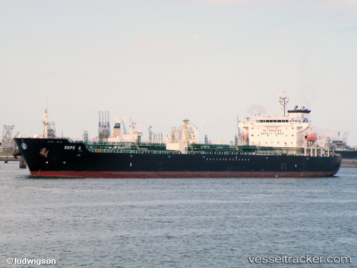
 Hope A
Current Status
Where is the vessel?
Hope A is currently in Near Thessaloniki, based on AIS data received about 15h ago.
Latest AIS update:
Current position: 40.61420° N, 22.92970° E (Near Thessaloniki)
Average speed (last 7 days): Loading…
Average speed (last 30 days): Loading…
Vessel profile: Hope A is a Chemical Oil Products Tanker with dimensions 171m x 28m.
This page combines live AIS, route history, probable destination signals, nearby traffic, and port activity for practical vessel monitoring.
The current position of vessel Hope A is 40.6142 lat / 22.9297 lng. Updated: 2026-05-23 19:49:36 UTCNearest reference points:
- Near Ammoulianí
- Near Agriá
- Near Volos
Currently sailing under the flag of Malta ![]()
Hope A built in 2004 year
Deadweight:
40095 tDetails:
Live Vessel Hope A Analytics (details, animations, etc.)
Recent AIS points (UTC):
2026-05-23 16:13:35 UTC · 40.61500, 22.93350 · SOG 0.3 kn · COG 265°2026-05-23 18:20:03 UTC · 40.61580, 22.93260 · SOG 0.1 kn · COG -1°
2026-05-23 19:46:36 UTC · 40.61370, 22.92980 · SOG 0.7 kn · COG 64°
2026-05-23 19:49:36 UTC · 40.61420, 22.92970 · SOG 0.6 kn · COG 84°