 TIANA
TIANA
Current Status
Where is the vessel?
TIANA is currently in 16 nm NE of Viinistu Sadam, based on AIS data received about 14h ago.
Latest AIS update:
Current position: 59.85179° N, 26.08215° E (16 nm NE of Viinistu Sadam)
Average speed (last 7 days): Loading…
Average speed (last 30 days): Loading…
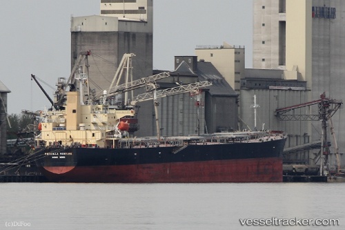
Vessel profile: TIANA is a Bulk Carrier with dimensions m x m.
This page combines live AIS, route history, probable destination signals, nearby traffic, and port activity for practical vessel monitoring.
The current position of vessel TIANA is 59.85179 lat / 26.08215 lng. Updated: 2026-05-23 19:52:06 UTCNearest reference points:
- 13 nm N of Viinistu Sadam
- Near Vessölandet
- Near Vuosaari (Nordsjö)
Currently sailing under the flag of Marshall Islands ![]()
Details:
Live Vessel TIANA Analytics (details, animations, etc.)
Recent AIS points (UTC):
2026-05-23 16:16:06 UTC · 59.85296, 26.08087 · SOG 0.8 kn · COG 271°2026-05-23 18:19:10 UTC · 59.85242, 26.08176 · SOG 0.6 kn · COG 252°
2026-05-23 19:49:08 UTC · 59.85222, 26.08186 · SOG 0.6 kn · COG 257°
2026-05-23 19:52:06 UTC · 59.85179, 26.08215 · SOG 0.4 kn · COG 284°