 GFS SAPPHIRE
Current Status
Where is the vessel?
GFS SAPPHIRE is currently in 63 nm NW of Cape Lopez, based on AIS data received about 14h ago.
Latest AIS update:
Current position: 0.31576° N, 8.25797° E (63 nm NW of Cape Lopez)
Average speed (last 7 days): Loading…
Average speed (last 30 days): Loading…
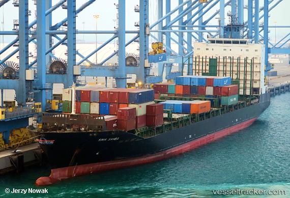
Vessel profile: GFS SAPPHIRE is a Container Ship with dimensions m x m.
This page combines live AIS, route history, probable destination signals, nearby traffic, and port activity for practical vessel monitoring.
The current position of vessel GFS SAPPHIRE is 0.31576 lat / 8.25797 lng. Updated: 2026-05-23 20:04:52 UTCNearest reference points:
- Near Cape Lopez
- Near Port Gentil
Currently sailing under the flag of Malta ![]()
Details:
Live Vessel GFS SAPPHIRE Analytics (details, animations, etc.)
Recent AIS points (UTC):
2026-05-23 15:56:11 UTC · -0.55227, 8.18168 · SOG 12.3 kn · COG -1°2026-05-23 17:34:21 UTC · -0.21526, 8.21415 · SOG 12.6 kn · COG -1°
2026-05-23 20:01:14 UTC · 0.30286, 8.25717 · SOG 12.5 kn · COG -1°
2026-05-23 20:04:52 UTC · 0.31576, 8.25797 · SOG 12.4 kn · COG -1°