 SOLARIS
Current Status
Where is the vessel?
SOLARIS is currently in 21 nm N of Port Said, based on AIS data received about 15h ago.
Latest AIS update:
Current position: 31.61657° N, 32.37993° E (21 nm N of Port Said)
Average speed (last 7 days): Loading…
Average speed (last 30 days): Loading…
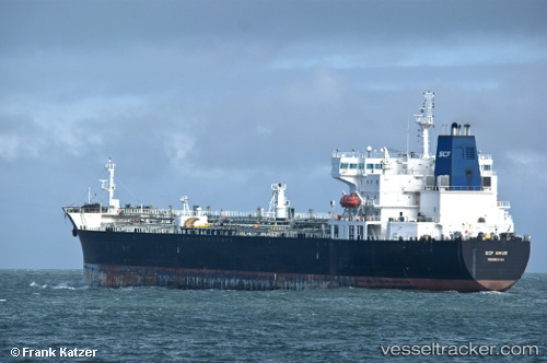
Vessel profile: SOLARIS is a Oil Products Tanker with dimensions m x m.
This page combines live AIS, route history, probable destination signals, nearby traffic, and port activity for practical vessel monitoring.
The current position of vessel SOLARIS is 31.61657 lat / 32.37993 lng. Updated: 2026-05-23 16:18:17 UTCNearest reference points:
- 16 nm N of Port Said
- 14 nm N of Port Said
- 15 nm N of Port Said
Currently sailing under the flag of Oman ![]()
Details:
Live Vessel SOLARIS Analytics (details, animations, etc.)
Recent AIS points (UTC):
2026-05-23 13:21:08 UTC · 31.61690, 32.38043 · SOG 0 kn · COG 336°2026-05-23 14:09:29 UTC · 31.61668, 32.38013 · SOG 0 kn · COG 341°
2026-05-23 15:26:28 UTC · 31.61660, 32.37997 · SOG 0 kn · COG 345°
2026-05-23 16:18:17 UTC · 31.61657, 32.37993 · SOG 0 kn · COG 346°