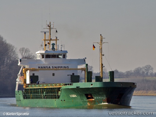
 KAISA
KAISA
Current Status
Where is the vessel?
KAISA is currently in Near Hausvikstrand, based on AIS data received about 14h ago.
Latest AIS update:
Current position: 57.91998° N, 6.93294° E (Near Hausvikstrand)
Average speed (last 7 days): Loading…
Average speed (last 30 days): Loading…
Vessel profile: KAISA is a General Cargo with dimensions m x m.
This page combines live AIS, route history, probable destination signals, nearby traffic, and port activity for practical vessel monitoring.
The current position of vessel KAISA is 57.91998 lat / 6.93294 lng. Updated: 2026-05-23 23:06:36 UTCNearest reference points:
- Near Kirkehamn
- Near Åna-Sira
- Near Egersund
Currently sailing under the flag of Antigua and Barbuda ![]()
Details:
Live Vessel KAISA Analytics (details, animations, etc.)
Recent AIS points (UTC):
2026-05-23 20:02:45 UTC · 58.21460, 6.14051 · SOG 9.9 kn · COG 129°2026-05-23 20:21:26 UTC · 58.17929, 6.21112 · SOG 10 kn · COG 130°
2026-05-23 22:24:46 UTC · 57.96691, 6.72080 · SOG 10.3 kn · COG 112°
2026-05-23 23:06:36 UTC · 57.91998, 6.93294 · SOG 10.7 kn · COG 109°