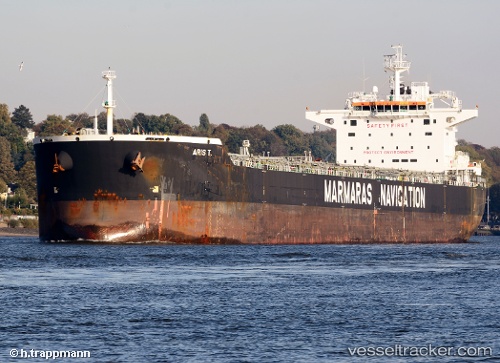
 ARIS T
Current Status
Where is the vessel?
ARIS T is currently in 166 nm NW of Crevedia, based on AIS data received about 15h ago.
Latest AIS update:
Current position: 46.67030° N, 28.54102° W (166 nm NW of Crevedia)
Average speed (last 7 days): Loading…
Average speed (last 30 days): Loading…
Vessel profile: ARIS T is a Bulk Carrier with dimensions m x m.
This page combines live AIS, route history, probable destination signals, nearby traffic, and port activity for practical vessel monitoring.
The current position of vessel ARIS T is 46.67030 lat / -28.54102 lng. Updated: 2026-05-23 22:55:44 UTCCurrently sailing under the flag of Malta ![]()
Details:
Live Vessel ARIS T Analytics (details, animations, etc.)
Recent AIS points (UTC):
2026-05-23 20:14:56 UTC · 46.49595, -29.22981 · SOG 11.4 kn · COG 69°2026-05-23 20:47:15 UTC · 46.52902, -29.08970 · SOG 11.4 kn · COG 67°
2026-05-23 22:16:21 UTC · 46.62751, -28.70772 · SOG 11.3 kn · COG 61°
2026-05-23 22:55:44 UTC · 46.67030, -28.54102 · SOG 11 kn · COG 73°