 Dinteldijk
Current Status
Where is the vessel?
Dinteldijk is currently in Near El Altet, based on AIS data received about 15h ago.
Latest AIS update:
Current position: 38.32834° N, 0.49600° W (Near El Altet)
Average speed (last 7 days): Loading…
Average speed (last 30 days): Loading…
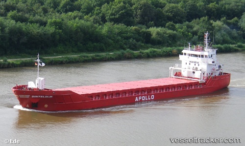
Vessel profile: Dinteldijk is a Multi Purpose Carrier with dimensions 90m x 14m.
This page combines live AIS, route history, probable destination signals, nearby traffic, and port activity for practical vessel monitoring.
The current position of vessel Dinteldijk is 38.32834 lat / -0.49600 lng. Updated: 2026-05-23 22:19:40 UTCNearest reference points:
- Near El Altet
- Near Campello
- Near Villajoyosa
Currently sailing under the flag of Netherlands ![]()
Dinteldijk built in 2007 year
Deadweight:
4450 tDetails:
Live Vessel Dinteldijk Analytics (details, animations, etc.)
Recent AIS points (UTC):
2026-05-23 19:17:13 UTC · 38.32833, -0.49500 · SOG 0 kn · COG -1°2026-05-23 20:01:45 UTC · 38.32834, -0.49599 · SOG 0 kn · COG 185°
2026-05-23 22:10:39 UTC · 38.32835, -0.49600 · SOG 0 kn · COG 185°
2026-05-23 22:19:40 UTC · 38.32834, -0.49600 · SOG 0 kn · COG 185°