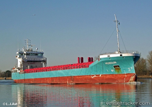
 VERTOM MERIDIAAN
Current Status
Where is the vessel?
VERTOM MERIDIAAN is currently in Near Jorf Lasfar, based on AIS data received about 14h ago.
Latest AIS update:
Current position: 33.11216° N, 8.71157° W (Near Jorf Lasfar)
Average speed (last 7 days): Loading…
Average speed (last 30 days): Loading…
Vessel profile: VERTOM MERIDIAAN is a General Cargo with dimensions m x m.
This page combines live AIS, route history, probable destination signals, nearby traffic, and port activity for practical vessel monitoring.
The current position of vessel VERTOM MERIDIAAN is 33.11216 lat / -8.71157 lng. Updated: 2026-05-23 11:12:36 UTCNearest reference points:
- Near Jorf Lasfar
- 21 nm NW of El Jadida
- 44 nm NW of El Jadida
Currently sailing under the flag of Netherlands ![]()
Details:
Live Vessel VERTOM MERIDIAAN Analytics (details, animations, etc.)
Recent AIS points (UTC):
2026-05-23 07:47:05 UTC · 33.11231, -8.71072 · SOG 0.1 kn · COG 350°2026-05-23 07:59:12 UTC · 33.11226, -8.71065 · SOG 0.1 kn · COG 356°
2026-05-23 09:48:00 UTC · 33.11213, -8.71094 · SOG 0.1 kn · COG 358°
2026-05-23 11:12:36 UTC · 33.11216, -8.71157 · SOG 0 kn · COG -1°