Oura
Current StatusWhere is the vessel?
Oura is currently in 65 nm NE of Kampung Tanjung Langsat, based on AIS data received about 14h ago.
Latest AIS update:
Current position: 2.20972° N, 104.79423° E (65 nm NE of Kampung Tanjung Langsat)
Average speed (last 7 days): Loading…
Average speed (last 30 days): Loading…
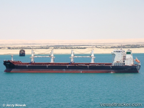
Vessel profile: Oura is a Bulk Carrier with dimensions 32m x 190m.
This page combines live AIS, route history, probable destination signals, nearby traffic, and port activity for practical vessel monitoring.
The current position of vessel Oura is 2.20972 lat / 104.79423 lng. Updated: 2026-05-24 08:04:13 UTCNearest reference points:
- 64 nm NE of PENGERANG
- 53 nm NE of PENGERANG
- 52 nm NE of PENGERANG
Details:
Live Vessel Oura Analytics (details, animations, etc.)
Recent AIS points (UTC):
2026-05-24 04:31:16 UTC · 2.21054, 104.79464 · SOG 0 kn · COG 296°2026-05-24 06:23:07 UTC · 2.20833, 104.79333 · SOG 0 kn · COG -1°
2026-05-24 07:41:05 UTC · 2.20833, 104.79333 · SOG 0 kn · COG -1°
2026-05-24 08:04:13 UTC · 2.20972, 104.79423 · SOG 0 kn · COG 318°