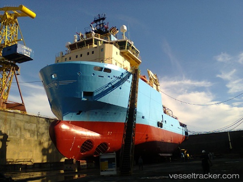
Maersk Topper
Current StatusWhere is the vessel?
Maersk Topper is currently in Near NITEROI, based on AIS data received about 14h ago.
Latest AIS update:
Current position: 22.84372° S, 43.14291° W (Near NITEROI)
Average speed (last 7 days): Loading…
Average speed (last 30 days): Loading…
Vessel profile: Maersk Topper is a Offshore Tug Supply Ship with dimensions 20m x 80m.
This page combines live AIS, route history, probable destination signals, nearby traffic, and port activity for practical vessel monitoring.
The current position of vessel Maersk Topper is -22.84372 lat / -43.14291 lng. Updated: 2026-05-23 09:44:28 UTCNearest reference points:
- Near NITEROI
- Near Rio De Janeiro
- Near Santos Dumont Apt/Rio de Janeiro
Details:
Live Vessel Maersk Topper Analytics (details, animations, etc.)
Recent AIS points (UTC):
2026-05-23 05:51:02 UTC · -22.84333, -43.14167 · SOG 0 kn · COG -1°2026-05-23 07:11:47 UTC · -22.84382, -43.14314 · SOG 0 kn · COG 99°
2026-05-23 08:09:04 UTC · -22.84333, -43.14167 · SOG 0 kn · COG -1°
2026-05-23 09:44:28 UTC · -22.84372, -43.14291 · SOG 0 kn · COG 180°