 NETA A.
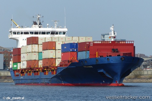
Current Status
Where is the vessel?
NETA A. is currently in 34 nm SW of Havdhem, based on AIS data received about 14h ago.
Latest AIS update:
Current position: 56.62497° N, 17.92064° E (34 nm SW of Havdhem)
Average speed (last 7 days): Loading…
Average speed (last 30 days): Loading…
Vessel profile: NETA A. is a Container Ship with dimensions m x m.
This page combines live AIS, route history, probable destination signals, nearby traffic, and port activity for practical vessel monitoring.
The current position of vessel NETA A. is 56.62497 lat / 17.92064 lng. Updated: 2026-05-23 13:18:24 UTCNearest reference points:
- Near WLADYSLAWOWO
- Near Gdynia
- 39 nm W of Pilies juru uosto PVP/Klaipeda
Currently sailing under the flag of Liberia ![]()
Details:
Live Vessel NETA A. Analytics (details, animations, etc.)
Recent AIS points (UTC):
2026-05-23 10:22:24 UTC · 57.09972, 18.97534 · SOG 15.6 kn · COG 227°2026-05-23 10:22:42 UTC · 57.09888, 18.97369 · SOG 15.6 kn · COG 227°
2026-05-23 12:22:55 UTC · 56.76352, 18.26345 · SOG 15.2 kn · COG 234°
2026-05-23 13:18:24 UTC · 56.62497, 17.92064 · SOG 15.3 kn · COG 234°