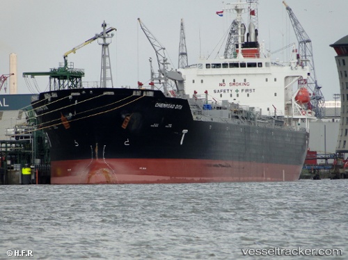
 Chemroad Dita
Current Status
Where is the vessel?
Chemroad Dita is currently in 184 nm SE of Gulfmex Lightering Area, based on AIS data received about 14h ago.
Latest AIS update:
Current position: 26.13356° N, 87.90770° W (184 nm SE of Gulfmex Lightering Area)
Average speed (last 7 days): Loading…
Average speed (last 30 days): Loading…
Vessel profile: Chemroad Dita is a Chemical Oil Products Tanker with dimensions 174m x 28m.
This page combines live AIS, route history, probable destination signals, nearby traffic, and port activity for practical vessel monitoring.
The current position of vessel Chemroad Dita is 26.13356 lat / -87.90770 lng. Updated: 2026-05-23 13:36:52 UTCCurrently sailing under the flag of Panama ![]()
Chemroad Dita built in 2009 year
Deadweight:
33554 tDetails:
Live Vessel Chemroad Dita Analytics (details, animations, etc.)
Recent AIS points (UTC):
2026-05-23 05:43:53 UTC · 27.64826, -88.72422 · SOG 13.2 kn · COG 158°2026-05-23 05:43:53 UTC · 27.64826, -88.72422 · SOG 13.2 kn · COG 158°
2026-05-23 12:43:14 UTC · 26.29200, -87.99475 · SOG 12.3 kn · COG 154°
2026-05-23 13:36:52 UTC · 26.13356, -87.90770 · SOG 11.2 kn · COG 161°