 BOBCAT
Current Status
Where is the vessel?
BOBCAT is currently in Near Stigsnaes Inter Terminal, based on AIS data received about 14h ago.
Latest AIS update:
Current position: 55.19269° N, 11.08042° E (Near Stigsnaes Inter Terminal)
Average speed (last 7 days): Loading…
Average speed (last 30 days): Loading…
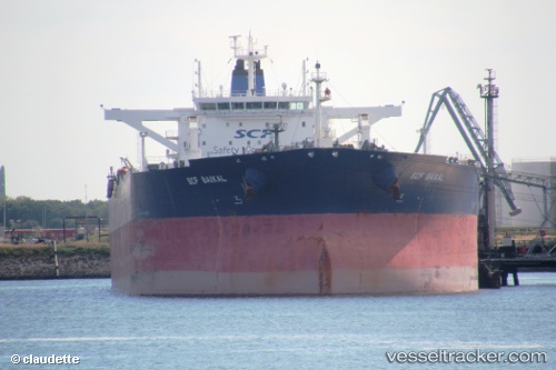
Vessel profile: BOBCAT is a Crude Oil Tanker with dimensions m x m.
This page combines live AIS, route history, probable destination signals, nearby traffic, and port activity for practical vessel monitoring.
The current position of vessel BOBCAT is 55.19269 lat / 11.08042 lng. Updated: 2026-05-23 13:18:23 UTCNearest reference points:
- Near Lindholm Havn
- Near Lundeborg
- Near SPODSBJERG
Currently sailing under the flag of Oman ![]()
Details:
Live Vessel BOBCAT Analytics (details, animations, etc.)
Recent AIS points (UTC):
2026-05-23 10:22:23 UTC · 54.69477, 10.77940 · SOG 12.3 kn · COG 0°2026-05-23 10:22:32 UTC · 54.69527, 10.77937 · SOG 12.3 kn · COG 0°
2026-05-23 12:22:51 UTC · 55.04186, 10.99769 · SOG 12.4 kn · COG 5°
2026-05-23 13:18:23 UTC · 55.19269, 11.08042 · SOG 10.1 kn · COG 55°