 ELEFTHEROTRIA
Current Status
Where is the vessel?
ELEFTHEROTRIA is currently in 11 nm S of Chalna, based on AIS data received about 14h ago.
Latest AIS update:
Current position: 22.28816° N, 89.58679° E (11 nm S of Chalna)
Average speed (last 7 days): Loading…
Average speed (last 30 days): Loading…
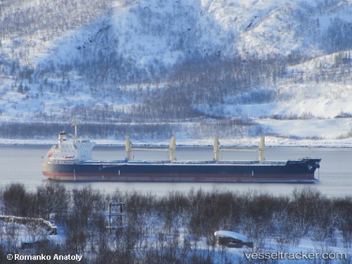
Vessel profile: ELEFTHEROTRIA is a Bulk Carrier with dimensions m x m.
This page combines live AIS, route history, probable destination signals, nearby traffic, and port activity for practical vessel monitoring.
The current position of vessel ELEFTHEROTRIA is 22.28816 lat / 89.58679 lng. Updated: 2026-05-23 09:38:55 UTCNearest reference points:
- Near Calcutta
- Near Haldia
- 16 nm SE of Contai
Currently sailing under the flag of Malta ![]()
Details:
Live Vessel ELEFTHEROTRIA Analytics (details, animations, etc.)
Recent AIS points (UTC):
2026-05-23 06:33:11 UTC · 22.30009, 89.60314 · SOG 0 kn · COG 209°2026-05-23 07:28:20 UTC · 22.29833, 89.60333 · SOG 0 kn · COG -1°
2026-05-23 08:16:21 UTC · 22.29833, 89.60333 · SOG 0 kn · COG -1°
2026-05-23 09:38:55 UTC · 22.28816, 89.58679 · SOG 8 kn · COG 210°