 Maple Star
Current Status
Where is the vessel?
Maple Star is currently in 27 nm NW of Walvisbaai, based on AIS data received about 15h ago.
Latest AIS update:
Current position: 22.77230° S, 14.03980° E (27 nm NW of Walvisbaai)
Average speed (last 7 days): Loading…
Average speed (last 30 days): Loading…
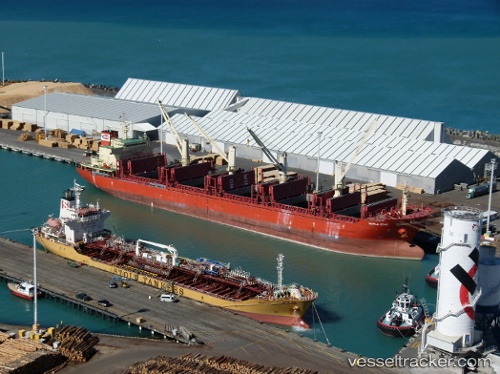
Vessel profile: Maple Star is a Bulk Carrier with dimensions 180m x 30m.
This page combines live AIS, route history, probable destination signals, nearby traffic, and port activity for practical vessel monitoring.
The current position of vessel Maple Star is -22.77230 lat / 14.03980 lng. Updated: 2026-05-23 20:21:02 UTCNearest reference points:
- Near WALVIS BAY
- 151 nm W of Henties Bay (Hentiesbaai)
- 161 nm W of Walvisbaai
Currently sailing under the flag of Marshall Is ![]()
Maple Star built in 2012 year
Deadweight:
35322 tDetails:
Live Vessel Maple Star Analytics (details, animations, etc.)
Recent AIS points (UTC):
2026-05-23 16:04:12 UTC · -22.85226, 14.09128 · SOG 1.5 kn · COG 279°2026-05-23 17:42:23 UTC · -22.81805, 14.07143 · SOG 1.4 kn · COG 282°
2026-05-23 20:03:24 UTC · -22.77739, 14.04274 · SOG 1.3 kn · COG 289°
2026-05-23 20:21:02 UTC · -22.77230, 14.03980 · SOG 0.8 kn · COG 279°