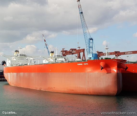
Marine Hope St
Current StatusWhere is the vessel?
Marine Hope St is currently in 119 nm SE of Shitan, based on AIS data received about 14h ago.
Latest AIS update:
Current position: 21.84667° N, 112.18167° W (119 nm SE of Shitan)
Average speed (last 7 days): Loading…
Average speed (last 30 days): Loading…
Vessel profile: Marine Hope St is a Crude Oil Tanker with dimensions 60m x 333m.
This page combines live AIS, route history, probable destination signals, nearby traffic, and port activity for practical vessel monitoring.
The current position of vessel Marine Hope St is 21.84667 lat / -112.18167 lng. Updated: 2026-05-23 10:42:34 UTCNearest reference points:
- 99 nm SE of Shitan
- 73 nm W of Los Cabos
- 71 nm W of Los Cabos
Details:
Live Vessel Marine Hope St Analytics (details, animations, etc.)
Recent AIS points (UTC):
2026-05-23 07:51:37 UTC · 21.57667, -111.59333 · SOG 12 kn · COG -1°2026-05-23 07:59:38 UTC · 21.58997, -111.62130 · SOG 12.5 kn · COG 294°
2026-05-23 09:34:28 UTC · 21.73747, -111.94509 · SOG 12.7 kn · COG 294°
2026-05-23 10:42:34 UTC · 21.84667, -112.18167 · SOG 12 kn · COG -1°