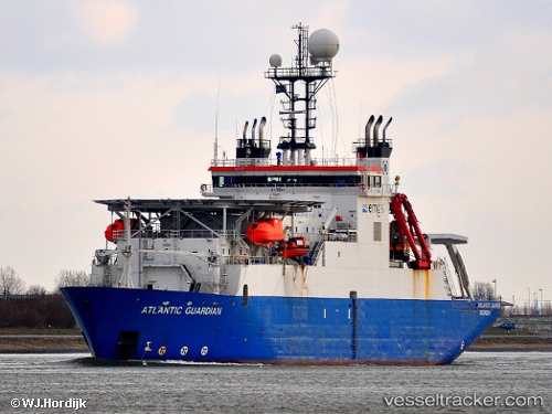
 ATLANTIC GUARDIAN
Current Status
Where is the vessel?
ATLANTIC GUARDIAN is currently in 21 nm SW of Colne, based on AIS data received about 14h ago.
Latest AIS update:
Current position: 55.16477° N, 0.33333° W (21 nm SW of Colne)
Average speed (last 7 days): Loading…
Average speed (last 30 days): Loading…
Vessel profile: ATLANTIC GUARDIAN is a Cable Layer with dimensions m x m.
This page combines live AIS, route history, probable destination signals, nearby traffic, and port activity for practical vessel monitoring.
The current position of vessel ATLANTIC GUARDIAN is 55.16477 lat / -0.33333 lng. Updated: 2026-05-23 13:55:36 UTCNearest reference points:
- 28 nm N of Weaverthorpe
- Near TYNE
- Near Flamborough
Currently sailing under the flag of Gibraltar ![]()
Details:
Live Vessel ATLANTIC GUARDIAN Analytics (details, animations, etc.)
Recent AIS points (UTC):
2026-05-23 11:15:15 UTC · 54.97242, -1.01557 · SOG 12.9 kn · COG 72°2026-05-23 11:38:16 UTC · 55.01511, -0.89167 · SOG 13.1 kn · COG 59°
2026-05-23 13:36:06 UTC · 55.14099, -0.43146 · SOG 11.1 kn · COG 69°
2026-05-23 13:55:36 UTC · 55.16477, -0.33333 · SOG 11.3 kn · COG 72°