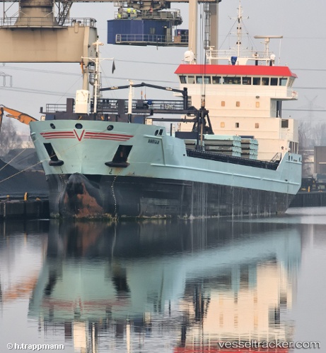
 Marfaam
Current Status
Where is the vessel?
Marfaam is currently in Near Hunsdon, based on AIS data received about 14h ago.
Latest AIS update:
Current position: 51.76023° N, 3.32968° E (Near Hunsdon)
Average speed (last 7 days): Loading…
Average speed (last 30 days): Loading…
Vessel profile: Marfaam is a Multi Purpose Carrier with dimensions 118m x 16m.
This page combines live AIS, route history, probable destination signals, nearby traffic, and port activity for practical vessel monitoring.
The current position of vessel Marfaam is 51.76023 lat / 3.32968 lng. Updated: 2026-05-23 16:01:47 UTCNearest reference points:
- Near Hunsdon
- 12 nm NE of Hunsdon
- Near OOSTWATERING
Currently sailing under the flag of Netherlands ![]()
Marfaam built in 2011 year
Deadweight:
8429 tDetails:
Live Vessel Marfaam Analytics (details, animations, etc.)
Recent AIS points (UTC):
2026-05-23 13:15:42 UTC · 51.76067, 3.32822 · SOG 0.4 kn · COG 15°2026-05-23 14:15:43 UTC · 51.76048, 3.32832 · SOG 0.1 kn · COG 17°
2026-05-23 15:55:47 UTC · 51.76023, 3.32953 · SOG 0 kn · COG 351°
2026-05-23 16:01:47 UTC · 51.76023, 3.32968 · SOG 0.1 kn · COG 349°