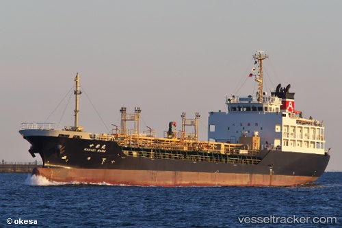
 NAKAEI
Current Status
Where is the vessel?
NAKAEI is currently in Near Sorong, based on AIS data received about 14h ago.
Latest AIS update:
Current position: 0.88787° S, 131.25104° E (Near Sorong)
Average speed (last 7 days): Loading…
Average speed (last 30 days): Loading…
Vessel profile: NAKAEI is a Tanker with dimensions m x m.
This page combines live AIS, route history, probable destination signals, nearby traffic, and port activity for practical vessel monitoring.
The current position of vessel NAKAEI is -0.88787 lat / 131.25104 lng. Updated: 2026-05-24 08:16:23 UTCNearest reference points:
- Near Sorong
- 60 nm W of Sorong
- Near TANGGUH
Currently sailing under the flag of Indonesia ![]()
Details:
Live Vessel NAKAEI Analytics (details, animations, etc.)
Recent AIS points (UTC):
2026-05-24 04:38:56 UTC · -0.75696, 131.26759 · SOG 11 kn · COG -1°2026-05-24 05:46:55 UTC · -0.86129, 131.19804 · SOG 7.5 kn · COG -1°
2026-05-24 07:34:22 UTC · -0.88704, 131.25153 · SOG 0.1 kn · COG -1°
2026-05-24 08:16:23 UTC · -0.88787, 131.25104 · SOG 0 kn · COG -1°