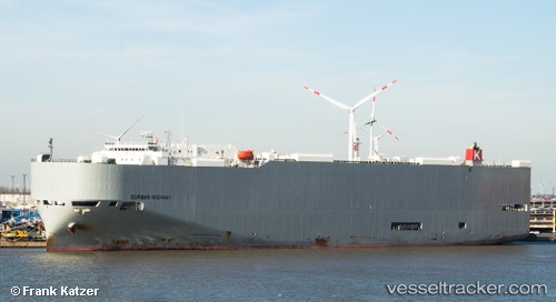
 Durban Highway
Current Status
Where is the vessel?
Durban Highway is currently in 38 nm SE of Malokurilskoe, based on AIS data received about 14h ago.
Latest AIS update:
Current position: 43.51687° N, 147.52853° E (38 nm SE of Malokurilskoe)
Average speed (last 7 days): Loading…
Average speed (last 30 days): Loading…
Vessel profile: Durban Highway is a Vehicles Carrier with dimensions 199m x 32m.
This page combines live AIS, route history, probable destination signals, nearby traffic, and port activity for practical vessel monitoring.
The current position of vessel Durban Highway is 43.51687 lat / 147.52853 lng. Updated: 2026-05-24 04:39:33 UTCNearest reference points:
- 27 nm SE of Tomari
- Near Yuzhno-Kuril'sk
- 11 nm NE of Tomari
Currently sailing under the flag of Panama ![]()
Durban Highway built in 2011 year
Deadweight:
18906 tDetails:
Live Vessel Durban Highway Analytics (details, animations, etc.)
Recent AIS points (UTC):
2026-05-24 01:36:59 UTC · 43.11185, 146.53421 · SOG 16.3 kn · COG 63°2026-05-24 01:57:23 UTC · 43.15469, 146.64493 · SOG 16.3 kn · COG 63°
2026-05-24 04:22:02 UTC · 43.47673, 147.43214 · SOG 16.4 kn · COG 59°
2026-05-24 04:39:33 UTC · 43.51687, 147.52853 · SOG 16.4 kn · COG 61°