 vesseltracker.com
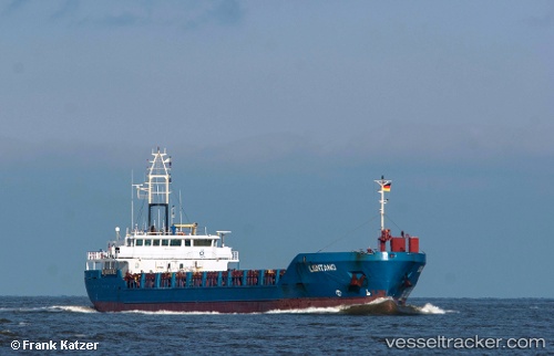
Find the position of the vessel Polyaland on the map. The latter are known coordinates and path.
marine traffic ship tracker show on live map
The current position of vessel Polyaland is 64.6538 lat / 24.4102 lng. Updated: 2024-04-19 21:25:51 UTCCurrently sailing under the flag of Gibraltar
Polyaland built in 2000 year
Port of registry:
Gibraltar (British Overseas Territory)Deadweight:
4135 tGross tonnage:
3244Service entry:
2000-01-01T00:00:00ZManufacturer:
Severnav (romanian shipyard)Details:
Last coordinates of the vessel:
UTC, 64.6538, 24.4102, course: 358, speed: 0UTC, 64.6538, 24.4102, course: 358, speed: 0
UTC, 64.6538, 24.4102, course: 358, speed: 0
2024-04-19 21:25:51 UTC, 64.6538, 24.4102, course: 358, speed: 0