 vesseltracker.com
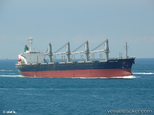
Find the position of the vessel Tanais Flyer on the map. The latter are known coordinates and path.
marine traffic ship tracker show on live map
The current position of vessel Tanais Flyer is 41.5025 lat / 29.1879 lng. Updated: 2025-04-03 16:50:38 UTCCurrently sailing under the flag of Belize
Tanais Flyer built in 1998 year
Port of registry:
Belize City (most populous city in Belize and capital of the district of Belize)Deadweight:
28674 tGross tonnage:
18061Service entry:
1998-01-01T00:00:00ZManufacturer:
Imabari Shipbuilding (Japanese shipbuilder)
Details:
Last coordinates of the vessel:
UTC, 41.507, 29.2194, course: -1, speed: 0.4UTC, 41.5042, 29.2083, course: -1, speed: 0.4
UTC, 41.5032, 29.2035, course: -1, speed: 0.4
2025-04-03 16:50:38 UTC, 41.5025, 29.1879, course: -1, speed: 0.4