vessel NIKITIS IMO: 9232450, Crude Oil Tanker vesseltracker.com
Vessel NIKITIS IMO: 9232450, Crude Oil Tanker
MMSI: 511100508 callsign: T8A3663 size: 244x42

Find the position of the vessel NIKITIS on the map. The latter are known coordinates and path.

marine traffic ship tracker show on live map

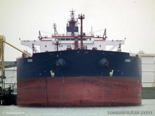
The current position of vessel NIKITIS is 25.7707 lat / 56.9732 lng. Updated: 2024-04-17 21:05:52 UTC

Currently sailing under the flag of Palau (Republic of)

NIKITIS built in 2002 year

Deadweight:
106106 t

Payload_mass:
106106 tonne
Gross tonnage:
57062
Service entry:
2002-01-01T00:00:00Z

Manufacturer:
Hyundai Mipo Dockyard (South Korean shipbuilding company)
Details:


Last coordinates of the vessel:
UTC, 25.7699, 56.9698, course: 129, speed: 0
UTC, 25.7707, 56.9716, course: 170, speed: 0.1
UTC, 25.7708, 56.9728, course: 201, speed: 0
2024-04-17 21:05:52 UTC, 25.7707, 56.9732, course: 211, speed: 0.1

Track of the vessel in the last 14 days


Most frequent ports a vessels calls at NIKITIS (511100508):

Malacca, traffic: 4
Ra’S Shukhayr, traffic: 2
Bur Ibrahim, traffic: 2
Strait Of Gibraltar, traffic: 1
Copenhagen, traffic: 1
Vostochny, traffic: 1
Dover, traffic: 1
Kobenhavn, traffic: 1
Port Said, traffic: 1
Primorsk, traffic: 1
Sambu, traffic: 1
Singapore, traffic: 1
Skagens Odde, traffic: 1

Link to the map:


Find another ship

NIKITIS (511100508) last ports (portcalls and passsages)

Vostochny | 2023-01-02 11:07:40
Singapore | 2022-10-15 01:20:13
Ra’S Shukhayr | 2022-09-14 10:52:21
Bur Ibrahim | 2022-09-13 16:39:04
Port Said | 2022-09-05 16:54:34
Ra’S Shukhayr | 2022-08-11 01:41:06
Dover | 2022-07-27 17:00:46
Primorsk | 2022-07-20 04:41:48
Kobenhavn | 2022-07-17 10:42:01
Skagens Odde | 2022-07-16 22:19:09
Strait Of Gibraltar | 2022-07-10 10:54:49
Bur Ibrahim | 2022-07-02 13:11:41
Malacca | 2022-06-08 22:52:34
Malacca | 2022-06-04 22:30:10
Malacca | 2022-05-31 22:03:58
Malacca | 2021-12-09 12:05:33