.
vessel LEILA IMO: 8906224, General Cargo Ship vesseltracker.com
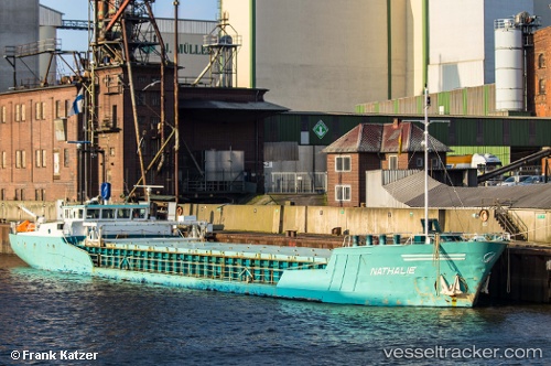
Vessel LEILA IMO: 8906224, MMSI: 210393000 General Cargo Ship

callsign: 5BYU5
size: x

Live AIS position: UTC. Near PALJASSAARE ), updated 2024-12-10 12:30:26 UTC.

Find the position of the vessel LEILA on the map. The latter are known coordinates and path.

marine traffic ship tracker show on live map

The current position of vessel LEILA is 59.45922 lat / 24.70448 lng. Updated: 2024-12-10 12:30:26 UTC

Currently sailing under the flag of Cyprus

LEILA built in 1989 year

Deadweight:
1300 t

Details:


Last coordinates of the vessel:
2024-12-10 12:30:26 UTC, 59.45922, 24.70448, course: 288, speed: 0

Track of the vessel in the last 28 days


Most frequent ports a vessels calls at LEILA (210393000):

Carrickfergus, traffic: 24
Belfast, traffic: 16
Liverpool, traffic: 12
Douglas, traffic: 4
Larne, traffic: 4
Londonderry, traffic: 4
Port Talbot, traffic: 4
Stornoway, traffic: 4
Workington, traffic: 4
Amlwch, traffic: 4
Inishtrahull, traffic: 2

Link to the map:


Find another ship

LEILA (210393000) last ports (portcalls and passsages)

Inishtrahull | 2022-02-07 08:42:44
Port Talbot | 2022-01-26 13:50:07
Stornoway | 2022-01-13 22:00:40
Londonderry | 2022-01-11 22:45:08
Workington | 2022-01-11 05:24:50
Larne | 2022-01-07 19:35:22
Carrickfergus | 2022-01-06 17:55:21
Carrickfergus | 2022-01-06 17:35:52
Belfast | 2021-12-30 20:05:14
Carrickfergus | 2021-12-30 19:40:50
Carrickfergus | 2021-12-30 19:35:29
Carrickfergus | 2021-12-30 19:30:22
Carrickfergus | 2021-12-23 07:40:51
Liverpool | 2021-12-16 21:30:06
Amlwch | 2021-12-09 05:49:05
Liverpool | 2021-12-05 20:00:55
Douglas | 2021-12-03 10:50:06
Liverpool | 2021-12-02 22:15:03