 vesseltracker.com
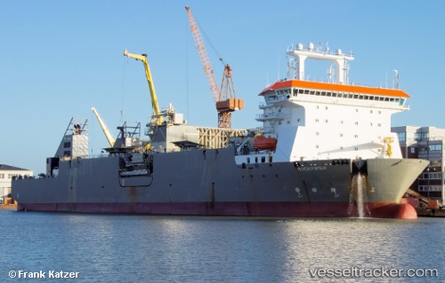
Vessel Rockpiper IMO: 9583861, MMSI: 209449000 Pipe Burying Vessel
UTC, 66.28138, 12.23478, course: 270, speed: 12.3
UTC, 66.20608, 11.12007, course: 254, speed: 12.2
2026-01-28 02:17:32 UTC, 66.13336, 10.22875, course: 259, speed: 12.5
Live AIS position:
UTC. 45 nm E of Urd),
updated 2026-01-28 02:17:32 UTC.
Find the position of the vessel Rockpiper on the map. The latter are known coordinates and path.
marine traffic ship tracker show on live map
The current position of vessel Rockpiper is 66.13336 lat / 10.22875 lng. Updated: 2026-01-28 02:17:32 UTCCurrently sailing under the flag of Cyprus
Rockpiper built in 2012 year
Deadweight:
26675 tDetails:
Last coordinates of the vessel:
UTC, 66.05761, 12.62679, course: 30, speed: 11.7UTC, 66.28138, 12.23478, course: 270, speed: 12.3
UTC, 66.20608, 11.12007, course: 254, speed: 12.2
2026-01-28 02:17:32 UTC, 66.13336, 10.22875, course: 259, speed: 12.5