 vesseltracker.com
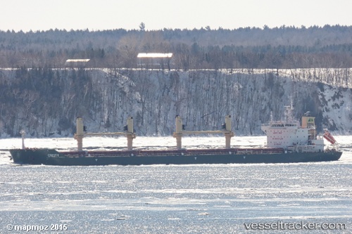
Vessel Cresty IMO: 9637143, MMSI: 210763000 Bulk Carrier
UTC, 46.82823, -71.19530, course: 244, speed: 2.2
UTC, 46.82257, -71.20275, course: 88, speed: 0
2026-01-28 17:48:27 UTC, 46.82246, -71.20284, course: 88, speed: 0
Live AIS position:
UTC. Near QUEBEC),
updated 2026-01-28 17:48:27 UTC.
Find the position of the vessel Cresty on the map. The latter are known coordinates and path.
marine traffic ship tracker show on live map
The current position of vessel Cresty is 46.82246 lat / -71.20284 lng. Updated: 2026-01-28 17:48:27 UTCDetails:
Last coordinates of the vessel:
UTC, 46.84283, -71.09175, course: 261, speed: 8.9UTC, 46.82823, -71.19530, course: 244, speed: 2.2
UTC, 46.82257, -71.20275, course: 88, speed: 0
2026-01-28 17:48:27 UTC, 46.82246, -71.20284, course: 88, speed: 0