 vesseltracker.com
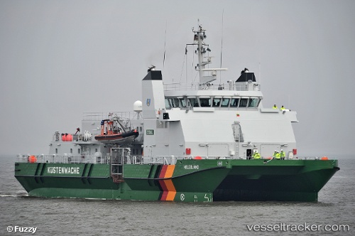
Vessel Helgoland IMO: 9500364, MMSI: 211450850 Patrol Vessel
UTC, 54.97490, 8.25653, course: 17, speed: 0.9
UTC, 54.97513, 8.22987, course: 29, speed: 0.7
2026-01-29 16:20:01 UTC, 54.97470, 8.25201, course: 17, speed: 0.6
Live AIS position:
UTC. Near Wenningstedt),
updated 2026-01-29 16:20:01 UTC.
Find the position of the vessel Helgoland on the map. The latter are known coordinates and path.
marine traffic ship tracker show on live map
The current position of vessel Helgoland is 54.97470 lat / 8.25201 lng. Updated: 2026-01-29 16:20:01 UTCCurrently sailing under the flag of Germany
Helgoland built in 2009 year
Deadweight:
132 tDetails:
Last coordinates of the vessel:
UTC, 54.96469, 8.22510, course: 128, speed: 0.9UTC, 54.97490, 8.25653, course: 17, speed: 0.9
UTC, 54.97513, 8.22987, course: 29, speed: 0.7
2026-01-29 16:20:01 UTC, 54.97470, 8.25201, course: 17, speed: 0.6