 vesseltracker.com
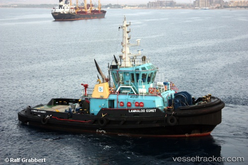
Vessel SL EGRET IMO: 9475911, MMSI: 212840000 Tug
UTC, 3.04500, 9.84833, course: -1, speed: 0
UTC, 3.04606, 9.84945, course: 231, speed: 0
2026-01-25 07:23:01 UTC, 3.04585, 9.84939, course: 333, speed: 0
Live AIS position:
UTC. Near Longji),
updated 2026-01-25 07:23:01 UTC.
Find the position of the vessel SL EGRET on the map. The latter are known coordinates and path.
marine traffic ship tracker show on live map
The current position of vessel SL EGRET is 3.04585 lat / 9.84939 lng. Updated: 2026-01-25 07:23:01 UTCCurrently sailing under the flag of Cyprus
SL EGRET built in 2008 year
Deadweight:
196 tDetails:
Last coordinates of the vessel:
UTC, 3.04500, 9.84833, course: -1, speed: 0UTC, 3.04500, 9.84833, course: -1, speed: 0
UTC, 3.04606, 9.84945, course: 231, speed: 0
2026-01-25 07:23:01 UTC, 3.04585, 9.84939, course: 333, speed: 0