 vesseltracker.com
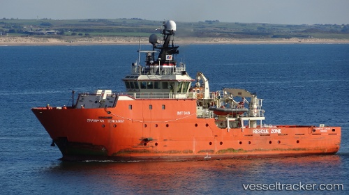
Vessel Grampian Conquest IMO: 9319222, MMSI: 235010030 Standby Safety Vessel
UTC, 58.91885, 5.58465, course: 345, speed: 0
UTC, 58.91882, 5.58462, course: 345, speed: 0
2026-02-01 13:30:01 UTC, 58.77065, 5.34731, course: 209, speed: 8.5
Live AIS position:
UTC. Near Tjelta),
updated 2026-02-01 13:30:01 UTC.
Find the position of the vessel Grampian Conquest on the map. The latter are known coordinates and path.
marine traffic ship tracker show on live map
The current position of vessel Grampian Conquest is 58.77065 lat / 5.34731 lng. Updated: 2026-02-01 13:30:01 UTCCurrently sailing under the flag of United Kingdom
Grampian Conquest built in 2005 year
Deadweight:
461 tDetails:
Last coordinates of the vessel:
UTC, 58.91887, 5.58464, course: 345, speed: 0UTC, 58.91885, 5.58465, course: 345, speed: 0
UTC, 58.91882, 5.58462, course: 345, speed: 0
2026-02-01 13:30:01 UTC, 58.77065, 5.34731, course: 209, speed: 8.5