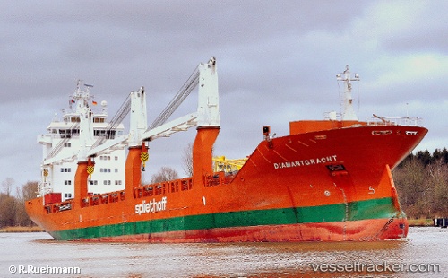
 Diamantgracht
Current Status
Where is the vessel?
Diamantgracht is currently in 106 nm SE of Offshore Ambrose, based on AIS data received about 14h ago.
Latest AIS update:
Current position: 39.08833° N, 70.22500° W (106 nm SE of Offshore Ambrose)
Average speed (last 7 days): Loading…
Average speed (last 30 days): Loading…
Vessel profile: Diamantgracht is a General Cargo Ship with dimensions 157m x 157m.
This page combines live AIS, route history, probable destination signals, nearby traffic, and port activity for practical vessel monitoring.
The current position of vessel Diamantgracht is 39.08833 lat / -70.22500 lng. Updated: 2026-05-28 06:21:18 UTCNearest reference points:
- 114 nm SE of Offshore Ambrose
- 126 nm SE of Offshore Ambrose
- 187 nm SE of Offshore Ambrose
Currently sailing under the flag of Netherlands ![]()
Diamantgracht built in 2009 year
Deadweight:
17966 tDetails:
Live Vessel Diamantgracht Analytics (details, animations, etc.)
Recent AIS points (UTC):
2026-05-28 01:51:42 UTC · 39.91154, -69.36277 · SOG 13.9 kn · COG 218°2026-05-28 03:50:44 UTC · 39.54853, -69.74118 · SOG 14.2 kn · COG 219°
2026-05-28 04:00:04 UTC · 39.51946, -69.77073 · SOG 14.1 kn · COG 218°
2026-05-28 06:21:18 UTC · 39.08833, -70.22500 · SOG 14 kn · COG -1°