 vesseltracker.com
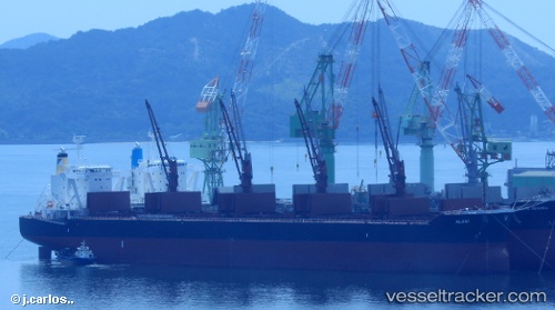
Vessel Alani IMO: 9782352, MMSI: 249726000 Bulk Carrier
UTC, 12.55027, 101.20148, course: 135, speed: 0.2
UTC, 12.55039, 101.20369, course: 219, speed: 0
2026-01-30 08:20:15 UTC, 12.54987, 101.20412, course: 238, speed: 0
Live AIS position:
UTC. Near Map Ta Phut),
updated 2026-01-30 08:20:15 UTC.
Find the position of the vessel Alani on the map. The latter are known coordinates and path.
marine traffic ship tracker show on live map
The current position of vessel Alani is 12.54987 lat / 101.20412 lng. Updated: 2026-01-30 08:20:15 UTCDetails:
Last coordinates of the vessel:
UTC, 12.54871, 101.20077, course: 77, speed: 0UTC, 12.55027, 101.20148, course: 135, speed: 0.2
UTC, 12.55039, 101.20369, course: 219, speed: 0
2026-01-30 08:20:15 UTC, 12.54987, 101.20412, course: 238, speed: 0