 vesseltracker.com
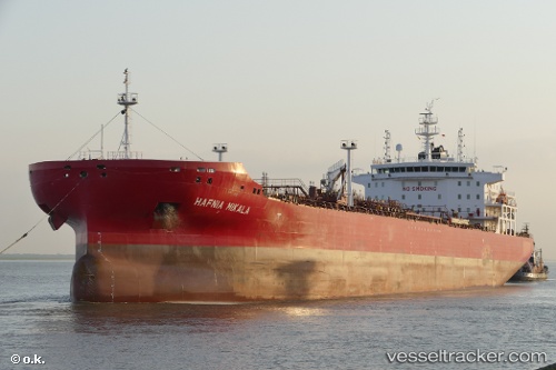
Find the position of the vessel Hafnia Mikala on the map. The latter are known coordinates and path.
marine traffic ship tracker show on live map
The current position of vessel Hafnia Mikala is 57.4027 lat / 21.5472 lng. Updated: 2025-05-08 17:22:56 UTCCurrently sailing under the flag of
Hafnia Mikala built in 0 year
Port of registry:
Valletta (capital of Malta)Deadweight:
0 tPayload_mass:
49999 tonneGross tonnage:
29658Operator:
Thome Ship Management (shipping company)Service entry:
2017-01-01T00:00:00ZManufacturer:
CSSC Offshore & Marine Engineering Company (Chinese shipbuilding company)Details:
Last coordinates of the vessel:
UTC, 57.477, 21.4717, course: 356, speed: 0.2UTC, 57.4792, 21.4716, course: 335, speed: 0.7
UTC, 57.4499, 21.4663, course: 138, speed: 5.7
2025-05-08 17:22:56 UTC, 57.4027, 21.5472, course: 283, speed: 0