 vesseltracker.com
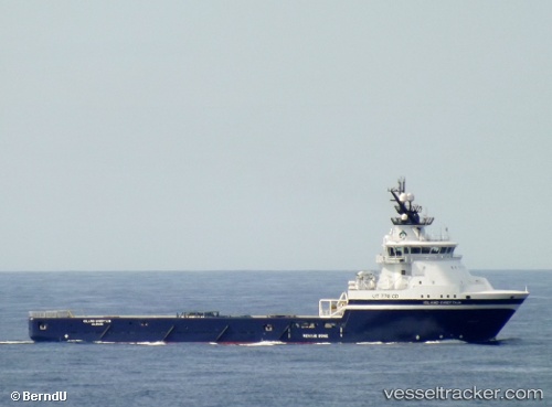
Vessel Island Chieftain IMO: 9419761, MMSI: 257236000 Offshore Tug Supply Ship
UTC, 57.70397, -2.97104, course: 82, speed: 0.4
UTC, 57.70394, -2.97106, course: 76, speed: 0.3
2026-01-29 09:34:27 UTC, 57.70400, -2.97106, course: 73, speed: 0.4
Live AIS position:
UTC. Near BUCKIE),
updated 2026-01-29 09:34:27 UTC.
Find the position of the vessel Island Chieftain on the map. The latter are known coordinates and path.
marine traffic ship tracker show on live map
The current position of vessel Island Chieftain is 57.70400 lat / -2.97106 lng. Updated: 2026-01-29 09:34:27 UTCCurrently sailing under the flag of Norway
Island Chieftain built in 2009 year
Deadweight:
4100 tDetails:
Last coordinates of the vessel:
UTC, 57.70374, -2.97109, course: 129, speed: 0.5UTC, 57.70397, -2.97104, course: 82, speed: 0.4
UTC, 57.70394, -2.97106, course: 76, speed: 0.3
2026-01-29 09:34:27 UTC, 57.70400, -2.97106, course: 73, speed: 0.4